We are committed to fostering growth, sustainability, safety, and quality service for the nation’s infrastructure through the support, promotion, and development of our group of companies.
The objective of conducting business in the sale of innovative engineering products. This includes equipment for surveying and data collection for planning and managing infrastructure.
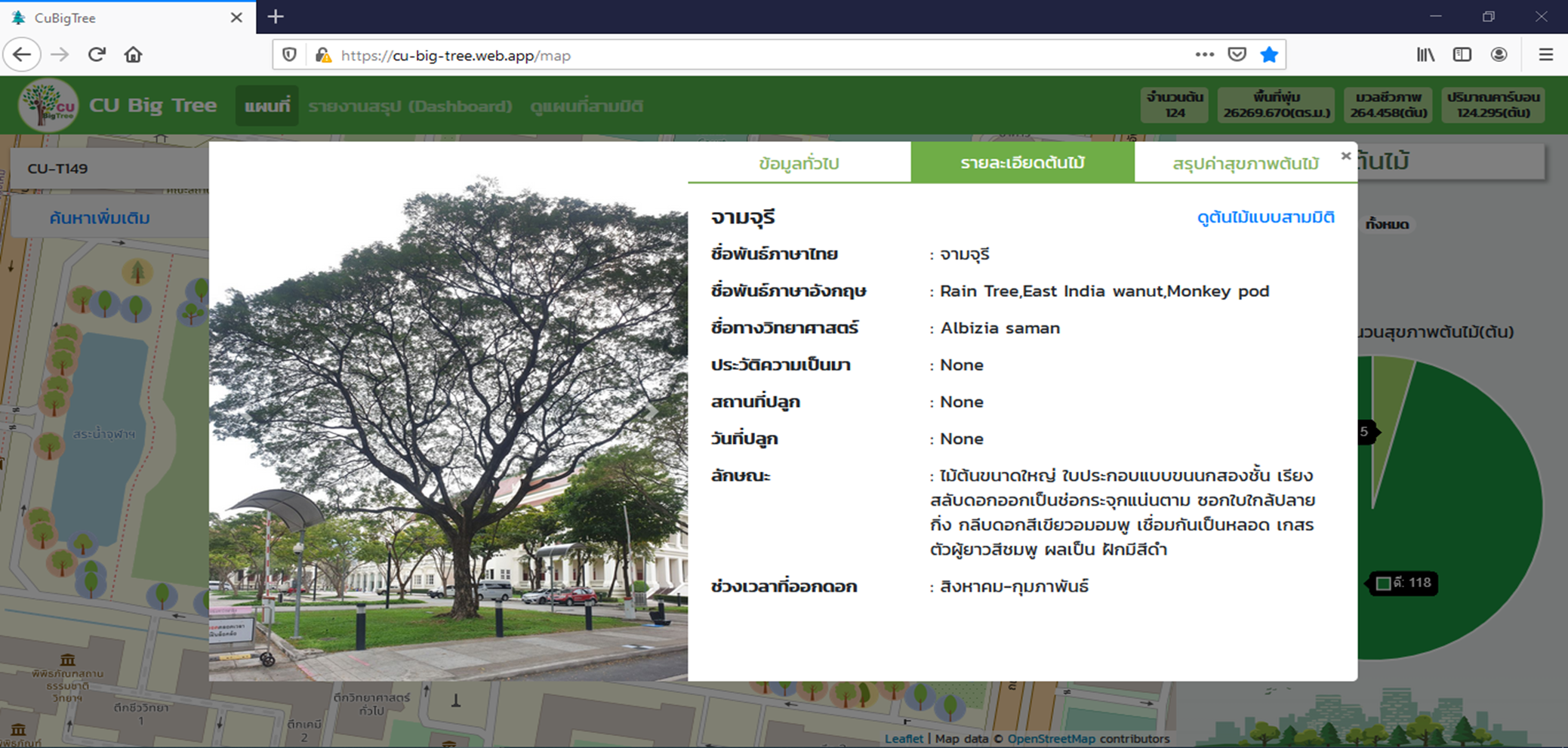
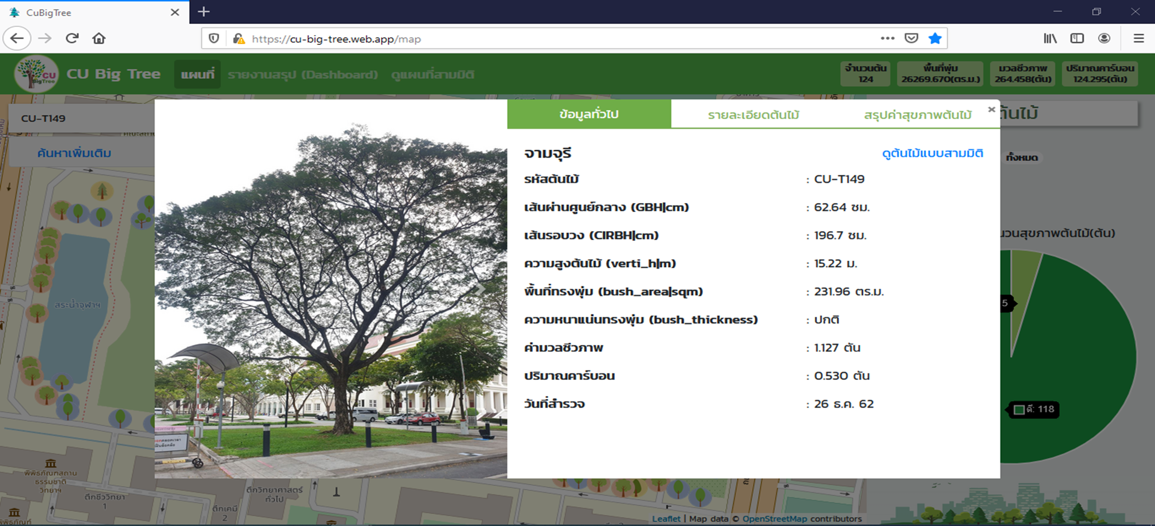
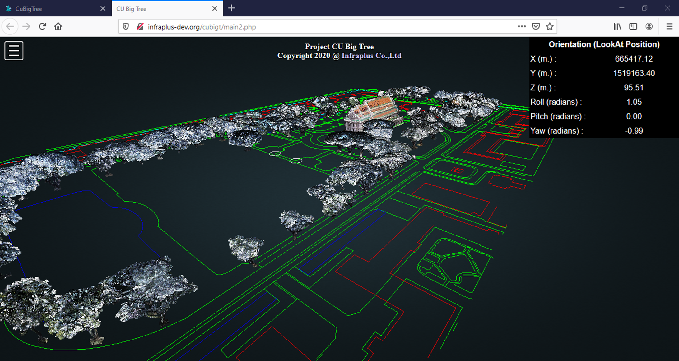
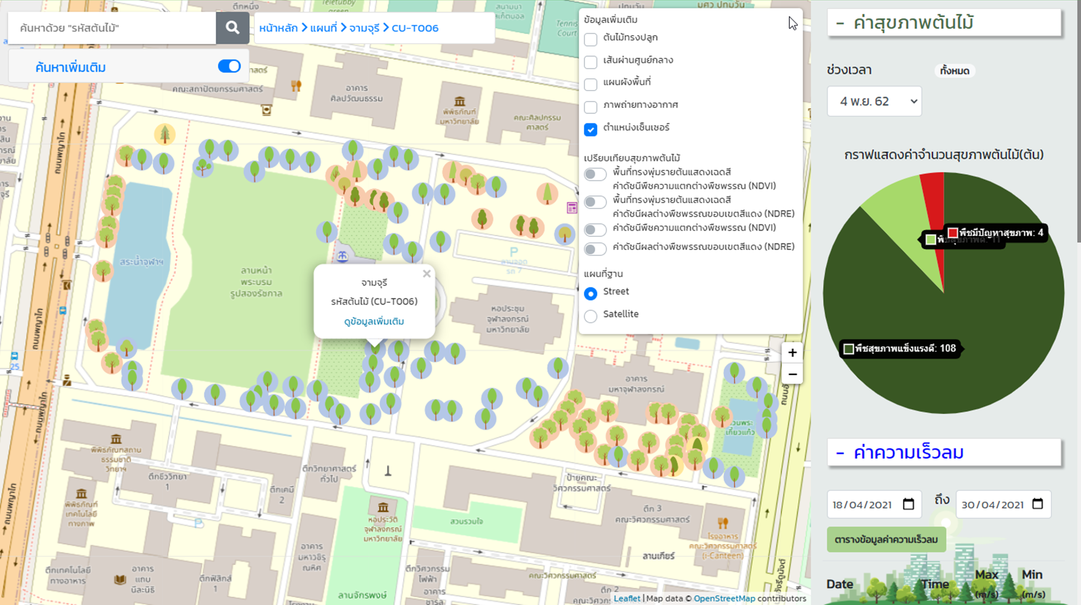
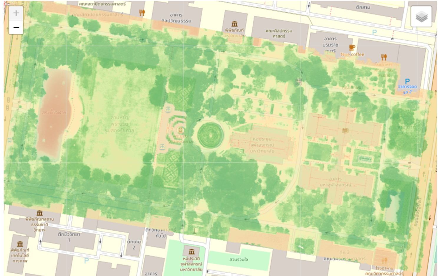
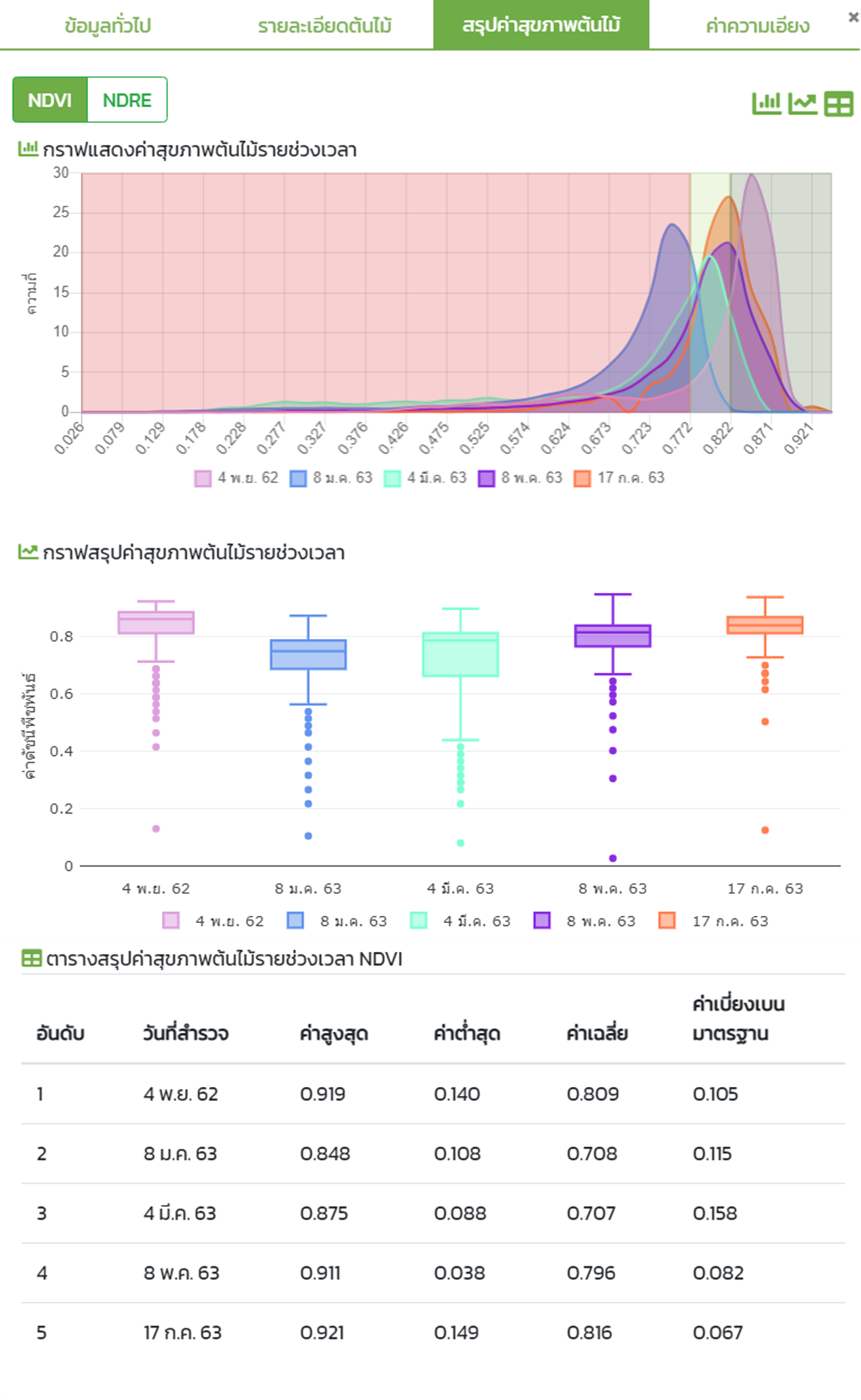
The CU Big Tree System was developed to manage large trees within the pilot urban area of Chulalongkorn University. Its purpose is to collect physical data of trees, such as height, girth, and crown size, alongside the use of modern survey technologies. These include aerial imagery captured by drones to generate the Normalized Difference Vegetation Index (NDVI), as well as LiDAR laser scanning, which can create detailed three-dimensional models of individual trees.
Data obtained from laser scanning improves the accuracy of analyzing tree structure, branches, and canopy distribution, which is valuable for assessing tree strength, risks, and advanced maintenance planning. To make this information easily accessible to the public, a web application has been developed to present tree details and locations via web maps, allowing citizens, researchers, and administrators to directly access the data. This proactive approach transforms tree management from merely repairing or maintaining after problems occur into monitoring tree health, predicting risks of collapse, and planning preventive care.
Beyond maintenance, the system also highlights environmental benefits, such as carbon absorption, providing shade to reduce urban heat, and serving as habitats for other organisms connected to the urban ecosystem. By making this information publicly available, the system encourages public participation, raises awareness of the value of large trees, and fosters a shared culture of conservation.