We are committed to fostering growth, sustainability, safety, and quality service for the nation’s infrastructure through the support, promotion, and development of our group of companies.
The objective of conducting business in the sale of innovative engineering products. This includes equipment for surveying and data collection for planning and managing infrastructure.
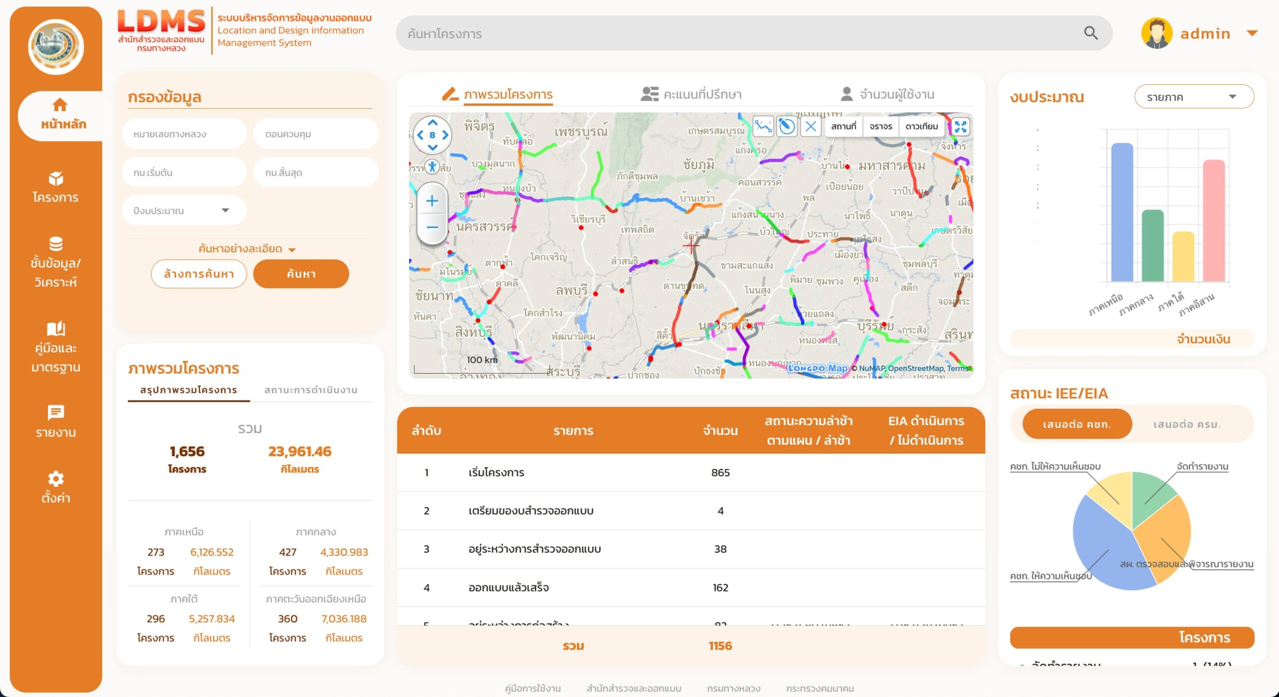
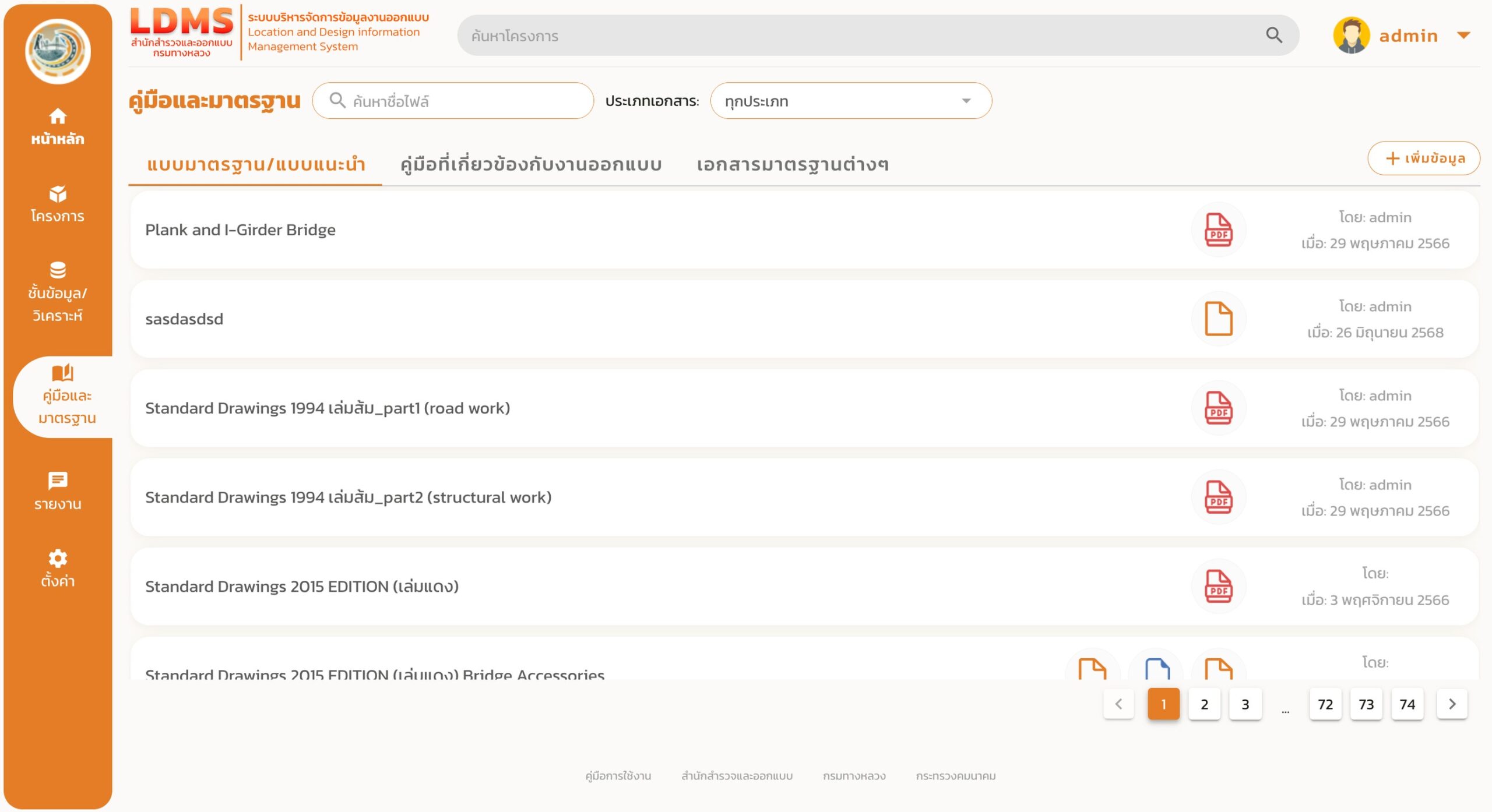
Location and Design Information Management System (LDMS)
Location and Design Information Management System (LDMS)
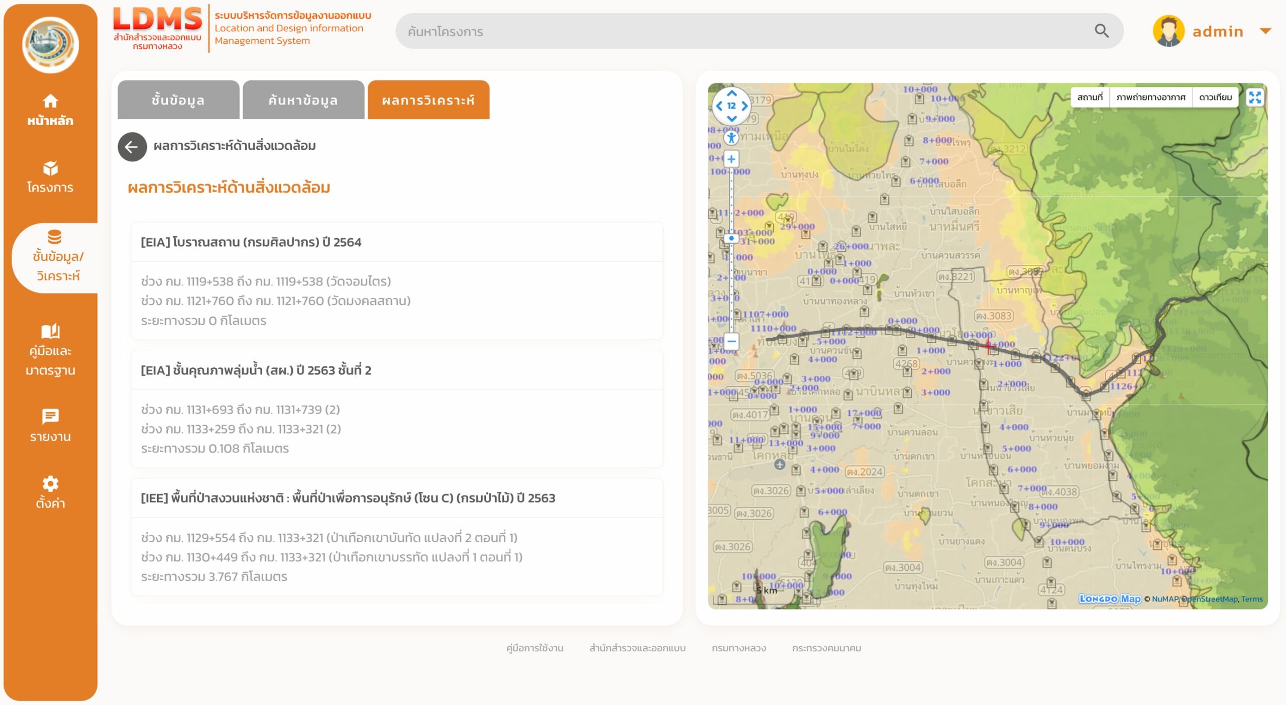
Location and Design Information Management System (LDMS) — https://ldms.doh.go.th/ — developed by the Bureau of Survey and Design, Department of Highways,
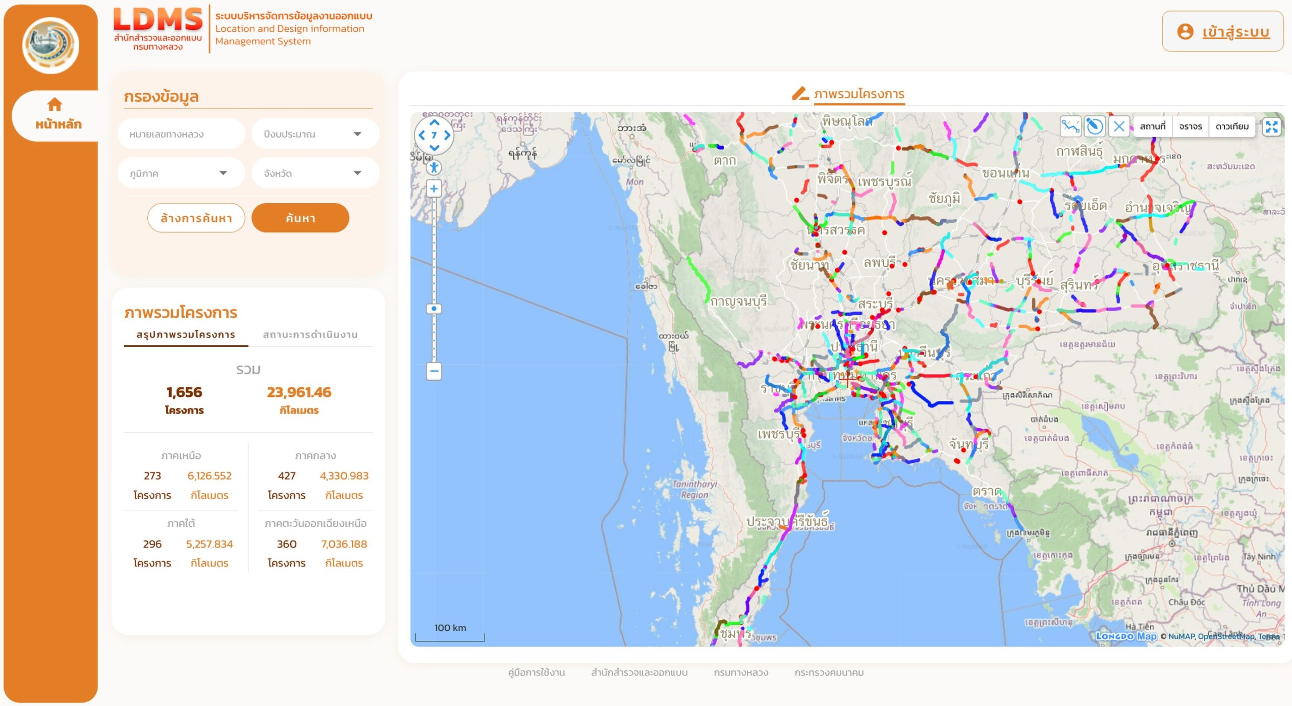
is designed to collect and store completed and ongoing survey and design documents. The system serves as a centralized database for design projects, enabling stakeholders to search for information to support planning, monitoring, evaluation, and design-related tasks, thereby enhancing both capability and efficiency.
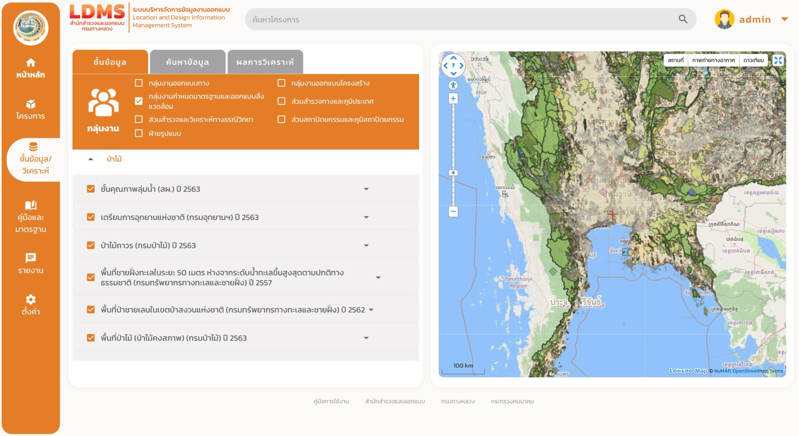
Additionally, LDMS integrates internal data from the Department of Highways to display route information for each project and connects to external data sources for preliminary data layer analysis in survey planning and for assessing data related to environmental impact reports (IEE/EIA). The system also allows users to track design progress, evaluate design performance, and assess consulting firms, providing convenience for users while aligning with the Bureau of Survey and Design’s workflow.