We are committed to fostering growth, sustainability, safety, and quality service for the nation’s infrastructure through the support, promotion, and development of our group of companies.
The objective of conducting business in the sale of innovative engineering products. This includes equipment for surveying and data collection for planning and managing infrastructure.
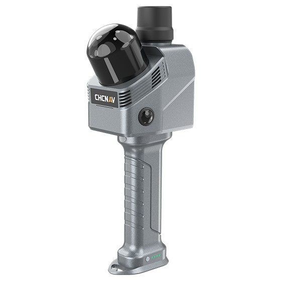
A handheld 3D LiDAR scanner for fast and accurate surveying and spatial data capture.
The RS07 combines LiDAR + INS + SLAM technology to capture spatial data and generate 3D Point Clouds in real time. It is ideal for building surveying, construction, BIM, and environments with limited GNSS availability.
Key Features
64-Channel LiDAR — Scanning rate of up to 1,152,000 points/second
INS + SLAM — Supports indoor surveying and environments with limited or unavailable GNSS signals
360° × 189° Field of View — Comprehensive coverage of the surrounding environment